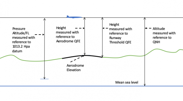
Altitudes and elevations are always measured relative to a defined level. The technical term for this is “datum“. The most commonly used datum is WGS 84, which refers to the World Geodetic System. GPS uses this datum. It corresponds to what laypeople think of as “mean sea level” (MSL), though hydrographers don’t.
Airliners can also measure their altitude via a radar altimeter. It directly measures the distance to the ground ... Read even more