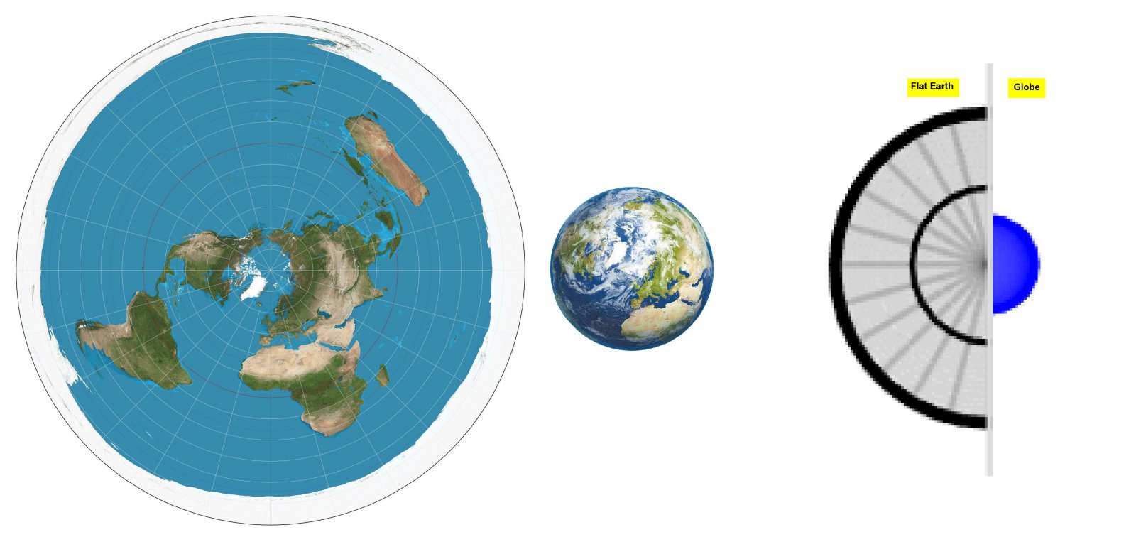
The idea of AE projection (azimuthal equidistant projection) is that the distances measured from a certain center point are preserved. The “semi-official” FE map is an AE map North Pole as the center point. So on the FE map, the distances measured from the North Pole are the same as on the globe map. In general, all distances measured along meridians are correct on the FE map.
Hardly anything else is correct. The areas of the Northern and Southern Hemispheres are of course the same in reality ... Read even more