This month
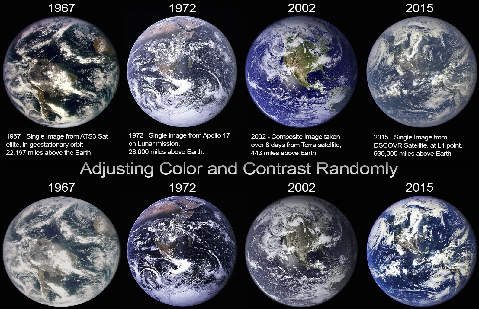
NASA released a new photo of the Earth from space, (the 2015 image above) taken from the DSCOVER satellite, 930,000 miles above the Earth.
Some people have claimed that this new image shows an increasingly hazy Earth, and that this is evidence of an increase in pollution, or a secret geoengineering program (using “chemtrails”). Some more extreme theorists have suggested that the image is fake because the continents (particularly North America) appear to be a different size to earlier photos.
The misconception comes from a misunderstanding about how the photos are taken. This new 2015 image is noteworthy because it’s the first time since 1972 that a good quality single image photograph has been taken of the Earth. The previous last image (in 1972) was taken by an astronaut from on board the Apollo 17 spacecraft during the last manned mission to the Moon. This was the first image called the “Blue Marble“ ... Read even more


