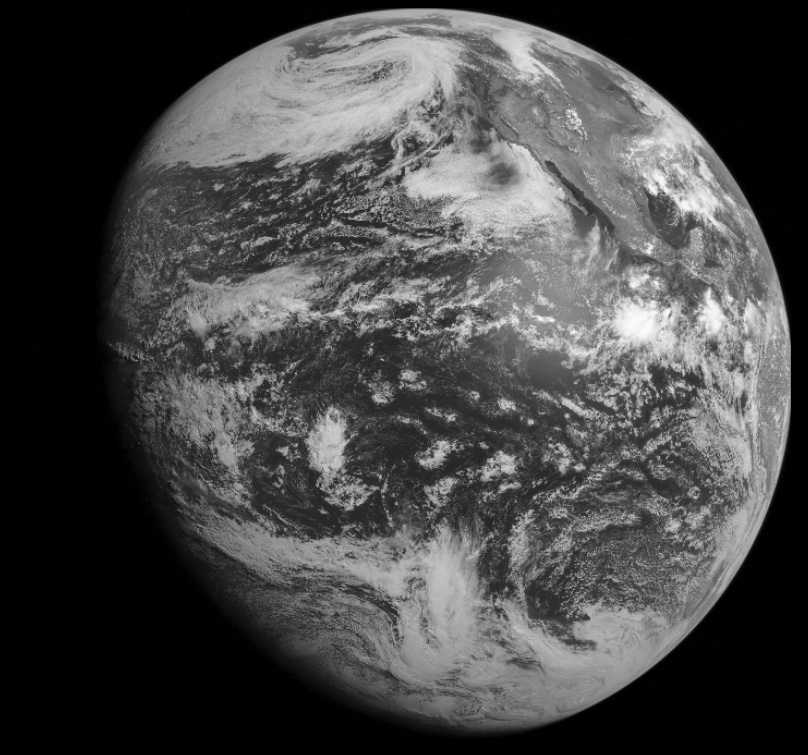
The above image was taken by the GOES-15 (West) satellite at 11AM (PDT) today, Jun 5, 2017. At least that’s what NASA would have you believe. But we don’t have to take their word for it, we can check for yourself.
Verifying that satellite images are real is done by comparing them against the “ground truth” – i.e. the actual situation on the ground. Here I’m going to focus on the GOES satellites, Particularly GOES-East and GOES-West. The process is:
- Pick a Satellite with the best view of your region
- Find out when it will take full-disk photos
- Pick a day when there’s some interesting clouds or contrails in the sky
- At that time go outside and take lots of photos in every direction (over five minutes or so)
- Wait for the full disk photo to be downloaded from the satellite and appear on the web site (about 35 to 40 minutes for GOES images)
- Compare your photos with the satellite image.
#1 – Pick a satellite. Here’s a variety of satellites that give high resolution full-disk images:
Since I’m in California I’m going to use the GOES-West satellite ... Read even more