ok I did play but not sure you can follow it.
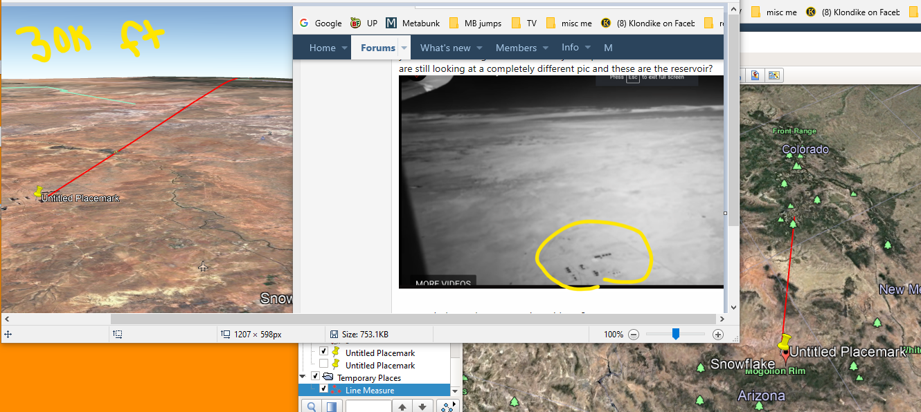
this pic is at 30,000 feet whatever distance I needed to make the sludge pools (im tired of trying to type reservoir), about the same size as your pic. my red line is 255miles. the light blue lines in the pics are border lines in Google Earth.
this is the look at 28,000 feet 50 miles south of the sludge pools.
now im following the red line but not changing my altitude because I don’t know how to calculate the angle my camera would change as I move closer to the Mountains. This means I am way too high as I move forward. but at least we can see what we see. here i am past the sludge pools at border line “A”
now im at the mountain range just past border line “B”. you can see the red line break in the photo just above. my yellow mountain range line to the sludge pool is 122 miles. i am still at 28 ... Read even more


