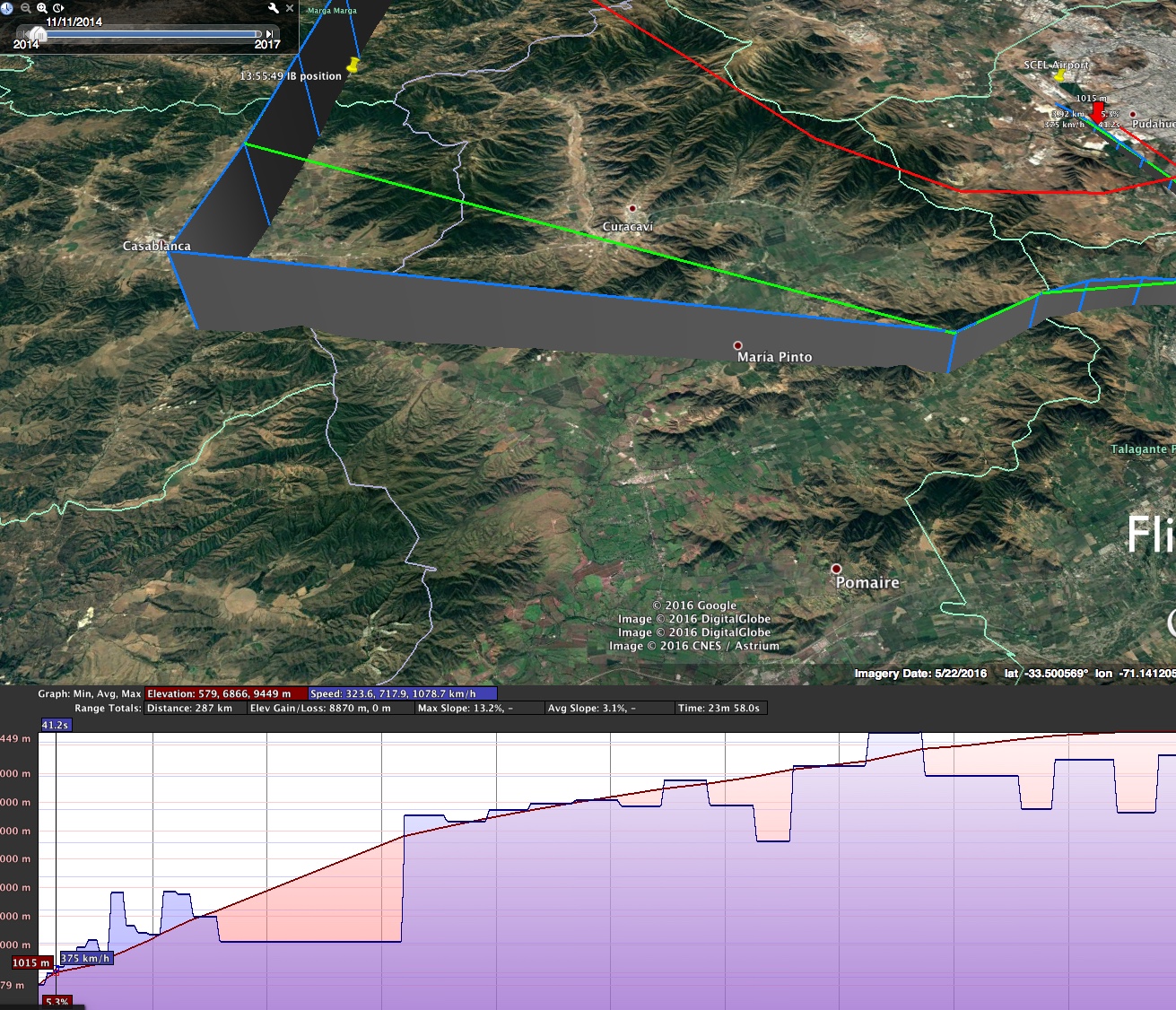
Attached is a “Local Only” section of the Flightaware data – easier to deal with for time scale and elevation profiles.
The elavation profile looks like this:
The big gap is the missing data. It goes 538 km/h, down to a flat 452 km/h, then jumps to 832 km/h
Altitude from 3194m to 5791m so over 11 steps that’s +236.09
The gap starts at 13:48:39 and ends at 13:53:59 (+5m20s, or 320 seconds).
The actual video starts at 13:51:55, and we first see the plane targeted at 13:52:31 ... Read even more